DJI Matrice 4E
DJI Matrice 4E
$6,229.00
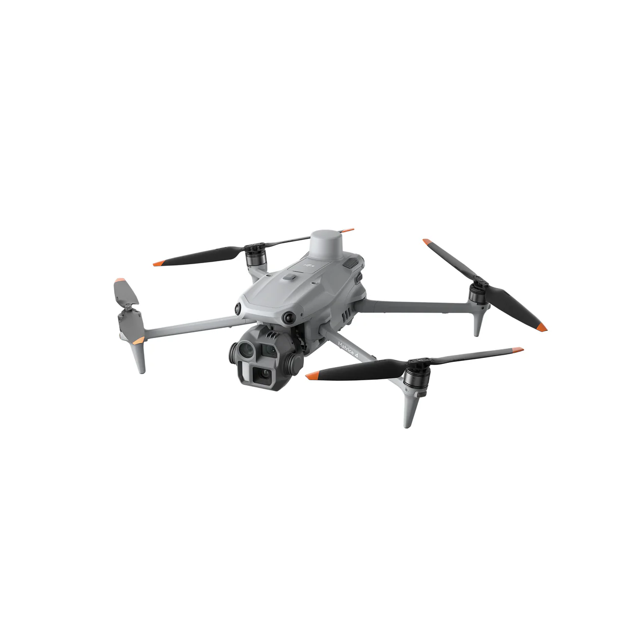
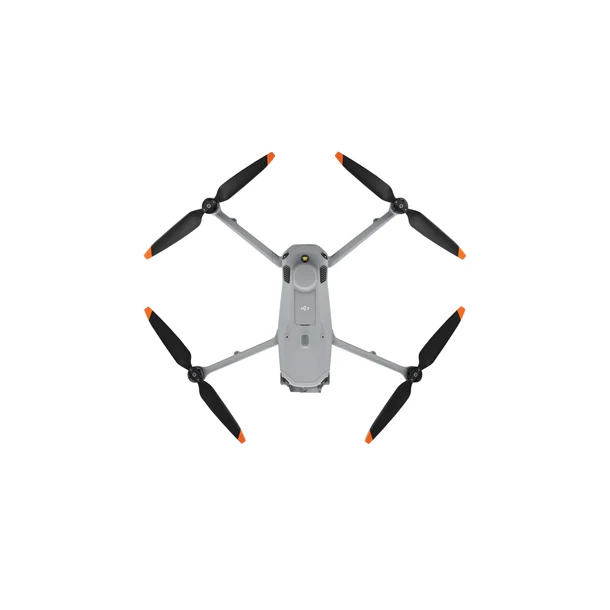
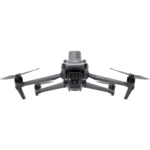
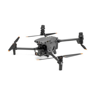
The DJI Matrice 4E (M4E) has been meticulously engineered to address the demands of geospatial professionals. Its intelligent design and advanced features streamline surveying and mapping tasks, ensuring greater accuracy, efficiency, and ease of use.
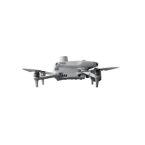
dji-matrice-4e-side
dji-matrice-4e-bottom
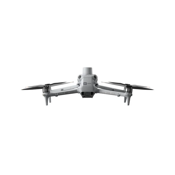
dji-matrice-4e-front
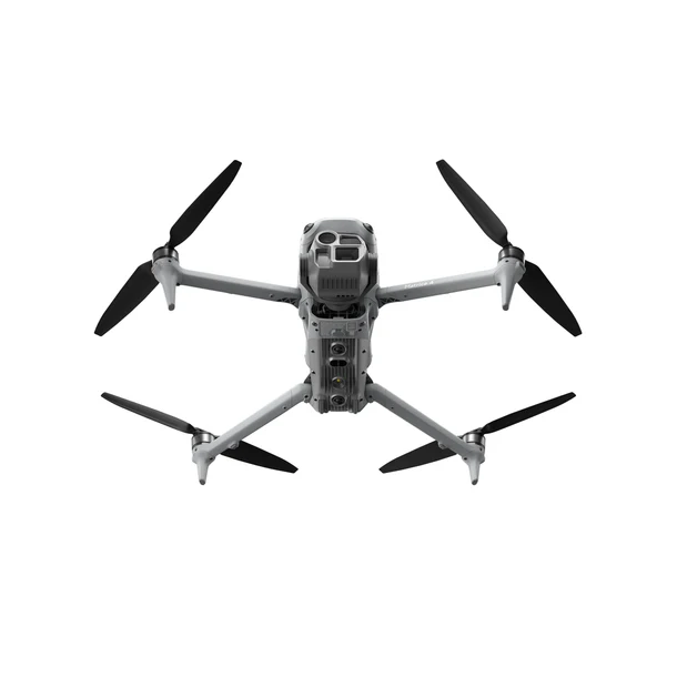
dji-matrice-4e-top
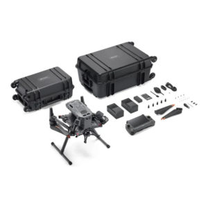
dji-matrice-4e
Additional information
DJI Matrice 4E
DJI Matrice 4E
A Precision Tool for Surveying and Mapping
The DJI Matrice 4E (M4E) has been meticulously engineered to address the demands of geospatial professionals. Its intelligent design and advanced features streamline surveying and mapping tasks, ensuring greater accuracy, efficiency, and ease of use.
Key Features for Surveying and Mapping
High Efficiency
Extended Flight Time: With a maximum flight time of 49 minutes when equipped with an RTK module, the M4E outperforms previous models, enabling longer operations and reducing the need for frequent battery changes.
Multi-Directional Imaging: Features 3-directional ortho capture and 5-directional oblique capture, which enhance mapping productivity by up to 40% compared to traditional methods.
Rapid Imaging: Captures images at intervals as short as 0.5 seconds, allowing for high-speed mapping over large areas.
Precision Technology
Distortion Correction 2.0: An upgraded correction system ensures residual distortion of less than 2 pixels, resulting in exceptional imaging accuracy. Factory-calibrated cameras paired with DJI Terra software deliver precise 3D reconstructions.
RTK Accuracy: Real-time kinematic (RTK) capabilities provide centimeter-level positioning for precise georeferencing.
Simplified Operations
Smart 3D Capture: Integrated with DJI Terra on the remote controller, it allows users to easily generate mapping routes and create detailed 3D models without external devices.
Obstacle Avoidance: Advanced sensors enable the drone to navigate complex environments safely, making close-range inspections and modeling more manageable.
DJI Matrice 4 Series: Setting a New Benchmark for Enterprise Drones
The DJI Matrice 4 Series revolutionizes the world of enterprise drones by combining compact design, intelligent features, and unparalleled versatility. This advanced lineup includes two flagship models: the Matrice 4T and Matrice 4E, designed to meet the unique demands of various industries. With cutting-edge AI capabilities and a precision laser rangefinder, the series offers exceptional performance, safety, and operational efficiency, making it a game-changer for businesses seeking next-level drone solutions.
Key Features of the Matrice 4 Series
Advanced Sensing and AI
Equipped with intelligent detection systems, the Matrice 4 Series ensures enhanced precision and safety in every flight.
Integrated AI capabilities allow for real-time data processing, improving operational efficiency and reducing human workload.
Enhanced Accessories
The upgraded accessories are designed to maximize functionality and extend the capabilities of the drones, supporting a wide range of enterprise applications.
Tailored Models for Specific Needs
Matrice 4T: Suited for industries such as emergency response, utilities, public safety, and forestry conservation.
Matrice 4E: Optimized for geospatial applications, including surveying, mapping, construction, and mining.
The Matrice 4 Series is the ideal solution for enterprises aiming to improve workflow efficiency, enhance safety, and unlock new possibilities in aerial operations.
Recommended Use Cases for the Matrice 4E
Large-Scale Mapping Projects
Advantages:
Extended flight time reduces operational downtime.
Multi-directional and high-speed imaging increases productivity.
Ideal for surveying and planning agencies, urban development teams, and government projects.
Detailed Building Modelling
Advantages:
Smart 3D capture ensures accurate models of structures.
Advanced obstacle avoidance allows safe operation in confined or intricate spaces.
Perfect for architectural design firms, conservation organizations, and fire departments managing structural evaluations.
Surface and Asset Inspections
Advantages:
Triple telephoto cameras provide detailed visuals for close-range inspections.
Vision positioning allows safe operation in low-GNSS environments.
Designed for industries such as infrastructure maintenance, bridge inspections, and powerline assessments.
Related products
Have Questions?
Everything Drone, in British Columbia