Agile Drone Services
LiDAR & Photogrammetry Drone Services in Victoria & Vancouver
At Agile Drone Services, we specialize in providing drone-based LiDAR and photogrammetry services tailored to your industry’s specific needs throughout Victoria & Vancouver, BC. Our mission is to empower you with high-quality data, enabling you to make informed decisions, boost efficiency, and drive innovation.
About Our LiDAR & Photogrammetry Drone Services
Whether it’s precision mapping, environmental monitoring, infrastructure assessment, or any other application, we’re here to help you harness the full potential of LiDAR and photogrammetry through drone technology. Feel free to reach out to the Agile Drone Services team with any further questions and to request service.
What is LiDAR?
What is Photogrammetry?
Photogrammetry is a technique that uses overlapping aerial
photographs to create precise 3D models and maps of objects, landscapes, or structures. It’s widely used in industries such as architecture, mining, agriculture, and environmental monitoring for various applications like site modelling and volume calculations.
What are flash maps?
For certain clients, we provide “flash maps” which are data reduced image captures that give excellent overhead views of a target property. Flash maps are made from combining a number of overhead images to create a seamless mosaic of a property. This product is an excellent choice for clients that need a very quick updated view of a property.


LiDAR USE CASES
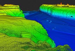
Topographic Mapping
LiDAR technology allows us to create highly accurate
and detailed topographic maps. By emitting laser pulses and measuring their return, LiDAR-equipped drones can capture elevation data with remarkable precision, making it an invaluable tool for land surveying, engineering, and urban planning.
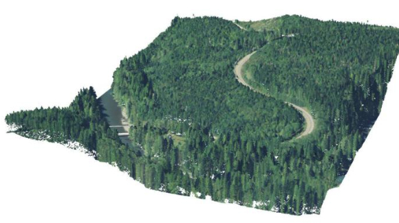
Forestry Management
In the field of forestry, LiDAR is essential for monitoring tree health, estimating timber volume, and identifying areas vulnerable to fire. Its ability to penetrate dense vegetation provides invaluable insights into the state of forests.
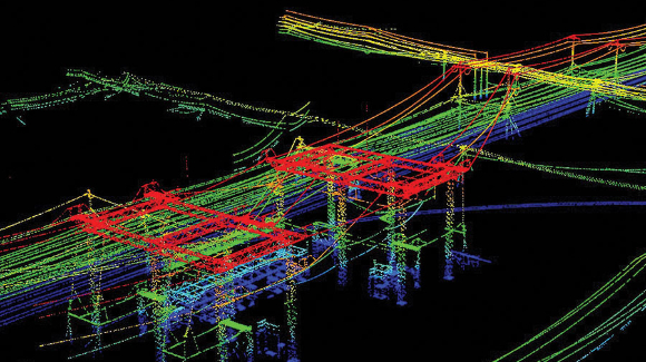
Infrastructure Inspection
LiDAR-equipped drones enable thorough inspection of critical infrastructure, including bridges, power lines, and pipelines. The technology’s ability to capture fine details and detect structural issues makes it a cost-effective solution for maintenance and safety assessments.
Environmental Monitoring & Assessment
Lidar is a powerful tool for environmental purposes. Lidar can be used to monitor reclamation and “Re-Wilding” efforts in salmon streams, valleys with erosion and flood deltas. The ability to capture data affordably allows for consistent monitoring and progress updates. Let us know about your project and we can put together a plan.
Photogrammetry Use Cases
3D Modeling
Photogrammetry uses aerial imagery to create detailed 3D
models of objects and landscapes. This technology is valuable in architectural design, cultural heritage preservation, and virtual reality applications.
Mining & Quarrying
The mining industry relies on photogrammetry to
monitor and manage stockpiles, track mining operations, and ensure efficient resource extraction. This technology aids in optimizing processes and reducing costs.
Environmental Conservation
Photogrammetry can be instrumental in tracking environmental changes, including coastline erosion, habitat monitoring, and wildlife population assessments. This is crucial for conservation efforts and biodiversity studies.
Construction & Real Estate
In the construction and real estate sectors, photogrammetry helps in project planning, progress monitoring, and site evaluation. Accurate aerial imagery simplifies decision making and enhances project management.
Ready to get off the ground?

Everything Drone, in British Columbia